This series has previously addressed magnetometry, electromagnetic induction and ground penetrating radar. Another sensing technique frequently used by archeologists and treasure hunters to find objects involves resistivity measurements. Unlike other sensing techniques, resistance measurements involve inserting metal probes into the ground rather than non-invasive surface measurements.
Since electrical currents are conducted through the soil by mineral salts contained in water, moisture content impacts the level of resistance in the soil and it varies based on buried archaeological features. For example, ditches and pits often have higher moisture and stone walls often have lower moisture so they stand out compared to the soil around them and can be detected in a resistive survey
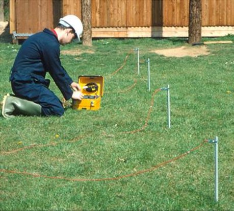
The resistivity meter technique uses a square frame with two or four metal electrodes, 50 or 100 centimeters apart along the base of the frame that are inserted into the soil with half or one meter spacing. When a brief pulse of weak electrical current is passed between the electrodes, the level of resistance (in ohms) is recorded on a data-logger. These readings are later downloaded onto a computer, where a graphics program produces a map of the resistance patterns across the survey area.
Source ABB.
Unlike the map produced by an earth resistance survey, an electrical resistivity tomography (ERT) survey provides a two-dimensional depth analysis across a survey area or feature.
With electrical resistivity imaging (ERI), researchers and treasure hunters can get a map of the depth of soils and rock and other objects. Typically, a row of about 24-48 sensors (metal stakes) are inserted along the ground in a straight line and the resistance measurements are only collected along that one line.
The next article in this series will discuss LiDAR (Light Detection and Ranging), another technique often combined with electromagnetic induction, magnetometry and/or electrical resistivity measurements.