
Archeological searching is being conducted from above at altitudes well below those of satellite orbits. One group of researchers has used an airborne laser scanner (ALS) mounted to a helicopter’s skid pad to reveal several cities between 900 and 1,400 years old beneath the tropical forest floor in Cambodia. The first LiDAR (light detection and […]
LIDAR
Using LIDAR for Transmission Power Lines
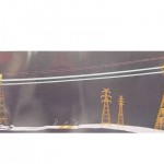
Dave Brown of Terra Remote Sensing explains the use of LIDAR (Light Detection And Ranging) technology to Randy Frank at the IEEE 2011 Power Systems Conference & Expo (PSCE) held March 20-23, 2011, in Phoenix, AZ. LIDAR is being widely used by utility companies to map transmission lines for adverse conditions and vegetation. For more […]